Get Supreme-Quality Images With Aerial Photo Editing Services

Short of visiting the site itself, aerial photography is the best way to get a complete sense of the surroundings. It’s great for real estate, weddings, and tourism when you want to capture a stunning view that provides a look into the bigger picture. With aerial photos, you get an impressive view, and your customers can make a more informed decision when they have the option to explore the area properly from a higher altitude.
Before After before Background Changeafter Background Change

Provide A Holistic Perception With Drone Image Editing Services

aerial view of the road

Drone Image
Color Cast Removal

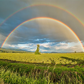
Present a realistic version of your property images by removing color imperfections.

Panorama Photo Stitching

Panorama
Photo Stitching

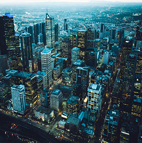
Create a complete, 360-degree overview of your property by combining multiple images.

Night sky

Sky
Replacement

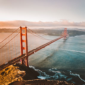
Replace gloomy backdrops with brighter skies to showcase appealing property images.

Perspective Correction

Perspective
Correction

Improve your images by correcting perspective distortions to provide a better view.

Photo Density Correction

Photo
Density Correction

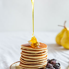
Ensure all the aspects that add to achieving the perfect exposure in all your shots.

Drone Image Blending

Drone
Image Blending

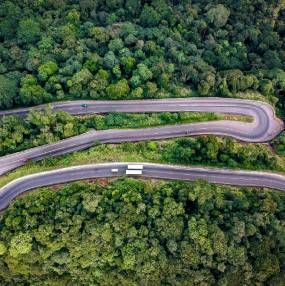
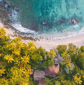
Create an accurate map of your property by stitching multiple aerial shots together.

Hue, Level & Saturation Adjustment

Hue, Level
& Saturation Adjustment

Balance brightness, boost intensity & remove color casts by tweaking the components.

Day To Night Conversion

Day To
Night Conversion

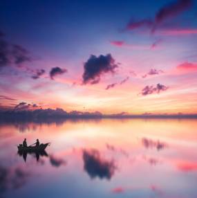
Improve aesthetics by presenting your property during twilight with clear details.

Shadow Editing

Shadow
Editing

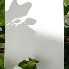
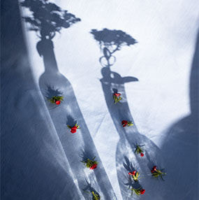
Enhance your images by adding natural shadows and removing unwanted shaded regions.

HDR Image Editing

HDR
Image Editing

Get polished property images with more visible details and overall correct exposure.

Color Correction

Color
Correction

Make your property shots look more elegant by conveying the right color and shades.

Virtual Tour Creation

Virtual
Tour Creation

Present better to potential buyers by providing a 360° virtual tour of the premises.

Enhance the Bird’s Eye View With Aerial Image Editing Services

  • Single Lot Highlight
    Highlight the property or piece of land with a color of your choice to distinguish it from the rest.
  • Multiple Lot Highlight
    Clearly display the different boundaries of multiple properties to mark the distinction between them.
  • Site Plan
    Help potential buyers visualize the site plan using boundaries and outlines on the existing images.
  • Drop Pin
    Provide a clear view of the property’s location and surrounding areas by pointing out nearby landmarks.
  • Color Fade
    Make your property stand out from the backdrop by keeping it natural while the rest becomes grayscale.
  • Editing Combo
    Shine a spotlight on your property using multiple editing techniques to focus on its best features.

Why Opt For Clipixie For Drone Photo Editing Services?

We guarantee excellence in real estate image editing by highlighting the best features of the property and all the conveniences it offers. Our team of experts caters to the needs of specific niches while ensuring the aerial shots attract potential buyers. At Clipixie, our professional editors have the required skill and knowledge to satisfy all your requirements, no matter how complex. Since aerial photography is one of the most sought out forms in the real estate industry, we can help you enhance your images and make them stand out to catch an interested buyer’s attention.

FAQs

The aerial perspective for taking shots is one of the most popular forms of photography in many industries, especially in real estate. It presents a unique view of the property and captures details that would otherwise not be visible in regular photography. Aerial photo editing services help you to set your pictures apart from the rest and attract potential buyers to your listing by enhancing the images that provide a broader context.
Aerial photography offers a lot of advantages, such as displaying the site location and nearby landmarks clearly. The improved vantage point offers a unique view that can be showcased better using aerial image editing services. Sometimes the shots can be messed up by unfavorable weather conditions, unwanted specks of dust on the camera lens, etc. Aerial photo editing services fixes this and also help to:
  • Remove unwanted flashes and reflections from the photos
  • Enhance still aerial shots
  • Edit blurred or unclear aerial photos
  • Incorporate required details into the images
  • Eliminate extra or unwanted outdoor elements
  • Reduce grainy noise in the aerial photographs
  • Change background colors, sky shades, etc.
  • Correct overexposure and underexposure
At Clipixie, our editors consider our client’s requirements to be their top priority- whether it is getting rid of trees, roof vents, or satellite dishes from images that hinder the ultimate view of their property. With access to the best software and tools available, we can transform your property images into a 360-degree virtual tour of the complete expanse of your real estate, attracting dozens of potential buyers. We deliver results that turn your images from dull, subdued shots of your property to eye-popping depictions of your premises, perfect to draw in interested buyers.
We offer comprehensive drone photo editing services that satisfy all of our clients’ purposes, and their cost depends on the complexity of the images you need to get edited. Each project is different based on the skill required to make the pictures perfect and the volume of the work involved. If you want an estimate of how much it would cost you to avail of aerial image editing services, get in touch with us.

Do You Have a Project for Us?

"*" indicates required fields

Drop files here or
Max. file size: 50 MB.
    Mobile